Rachel Neher
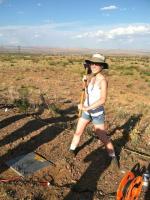
Rachel Neher is a student at Western Washington University currently completing her research at Virginia Tech under Dr. John Hole.
The aim of my project is to get a comprehensive picture of the tectonic boundary that occurs at the Salmon River Suture Zone. Located in Idaho and a small portion of eastern Oregon, this zone is where the Precambrian North American craton meets accreted terranes that now make up the Blue Mountain region of Oregon. The goal of the IDOR project is to understand how the accretionary edge of the continental margin was formed and subsequently modified by magmatism and stresses. Geochemical studies on the area have found a sharp isotopic gradient (Sr, O) that corresponds with a feature called the Western Idaho Shear Zone or WISZ for short. Batholiths have been emplaced in this area over time. The project aims to get a picture of the structure of this complex area.
Field Work Photos
November 20th, 2012
John Hole has put together a website with photos of field work. It also includes an overview of the proposal.
[url=http://www.geophys.geos.vt.edu/hole/idor/]http://www.geophys.geos.vt.edu/hole/idor/[/url]
Final Blog
September 3rd, 2012
I feel that my summer was a success, but not for the reasons that I thought it would be.
Listed below are the goals that I wrote on the back of the project summary page at the beginning of the summer.
First third of the internship:
1. learn to use all the programs to a level where I am proficient
2. mingle with the scientific community and make professional connections
3. Gain a full understanding of the goals and logistics of my project
During the first portion of the summer I learned to use a program called SeisSpace to pick arrival times for shot gather data from the Salton project. It was a good experience learning to use the program, because more than learning the specific program, I gained more experience picking the first arrival times of seismic waves within noise. It was good to be able to work with real data. As for the mingling with the scientific community I didn’t get to meet a lot of people in the first portion of my internship. I mostly met graduate students attending Virginia Tech. I read through the scientific proposal for the project and talked with Kathy Davenport, the PHD student in charge of IDOR. I gained a thorough understanding of the goals of the internship by reading this paper and discussing it, but it took going to the field for the first time to fully understand the logistics of the project.
Second third of the internship:
1. Have a clear visual idea of our survey area.
2. be confident and comfortable with directing others
During the middle of the internship we traveled to Idaho to survey the area of our study. While we were in Idaho I poured over route information to better understand where we are going. During the second trip, when we were completing the field work I created and scanned maps of the field area that were used to guide the deployers. Through these activities I gained a comprehensive knowledge of the study area. Traveling from town to town and surveying the line helped me gain a first hand knowledge of the area.
During the last bit of the internship, while in Idaho, I met the deployers at the door, checked them into their rooms and introduced myself. While I was there I felt like the deployers looked up to me and called me to help sort out problems.
Third third of the internship:
1. be physically fit enough for field work
2. write my abstract (and by proud of it)
During the last part of the internship we spent three days deploying the instruments. This required digging the holes with a pickax, placing the Texan at one end and securely placing the geophone in the other. After this we buried the entire thing. I was physically fit enough to do the work, which makes me feel proud.
I also finished my abstract, and feel proud of it.
I feel that my summer was a success because I learned a lot and felt like I gained a lot of independence. I feel more confident about my future now and more confident about making connections and looking for a graduate school for the coming year.
Field Work Overview
August 21st, 2012
haven't had a spare second to post for a while!
I am excited to announce that we have completed the field work with much success! We placed almost all of the texans (with some skipped due to equipment shortages and fire closures). We deployed instruments for three days, and I worked on the western half of the line while a team of deployers traveled east to Stanley, ID.

Then we got to have some fun on a geology based field trip while the shooting crew took care of their part of the job. The Texans and geophones (data collectors) picked up the energy.
At this point we were able to pick the instruments back up from the sites. This time I was sent with the Stanley crew to work on pickup. There are some quite large and uncontrolled fires in Idaho currently that at this time had grown quite large and filled the air in the town with smoke, making it important to keep people with breathing problems in Ontario, OR.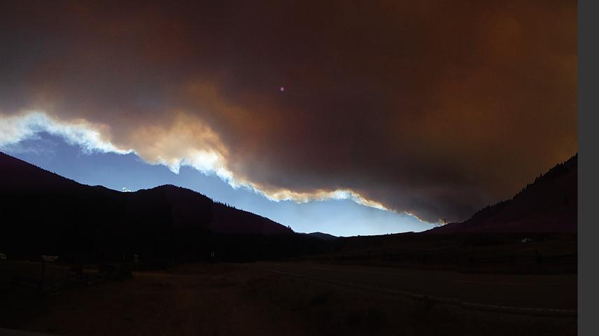
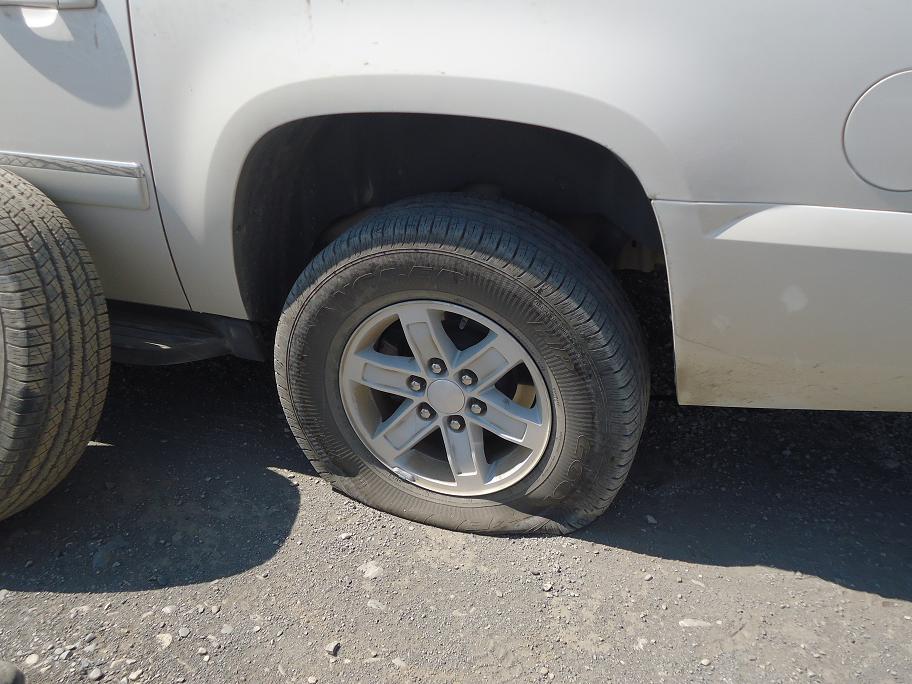
Being on the eastern end I got to work in the mountains and saw some amazing views. Picking up the texans was faster going than deploying them, so I spent the last day with our friends at Les Schwab getting all the tires fixed from the cars.
All in all, being here was a wonderful experience. I learned a lot (which will be reflected on in my next post) and met many amazing people. The data is coming in now and looking great. Despite minor setbacks along the way, the data collection is complete and I am excited to see the results and conclusions!

Field Work: Data Collection
August 10th, 2012
We've made it out to the field for the deployment of the instruments. The original surveying crew met up with a crew of 50+ people from many different universities, who have banded together to lend a hand in the deployment. We've been mostly training so far, but are poised to head out into the field tomorrow to start. First of all we will be deploying roughly 2600 instruments along the length of the line. After that we will use explosive shots, each buried 90 feet underground so that no surface damage occurs, to send energy through the earth. This energy will be picked up by the seismometers and downloaded after the seismometers are retrieved. The roughly 24 teams will be split between two bases of operation, one in the west and one in the east. We will be deploying geophones connected to one-channel dataloggers.
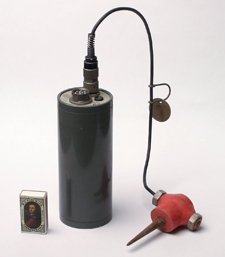
These dataloggers are RT125A or Texans and are primarily used for active source seismology since they have a relatively short battery life. The instruments are from the IRIS/PASSCAL instrument center in Socorro, NM.
I am excited for the field work to begin and to perfect how to dig a hole with a pickax. The adventure begins tomorrow morning, bright and early for some and a little later for those of us heading west.
Week Six- Back to Virginia!
July 29th, 2012
After landing back in Virginia I post-processed the GPS data and worked on my abstract this week. In the field our teams of two were split into separate jobs, one person hammered in the stake while the other person used a highly accurate GPS device called a Trimble to record the latitude, longitude and elevation of the stake's location. These data were stored in the device until the data from all four devices were downloaded into a university laptop. Though highly accurate, the accuracy of the points can be further improved through post-processing. I spent the first part of the week after arriving back post-processing the data. In essence, the data is fed through a program that searches out permanent GPS locations nearby to the data point recorded by the Trimble. It then uses these locations to refine the recorded locations to make the measurements more accurate, which is important in the code that will be run later. We are headed back to Idaho for deployment on Sunday, to meet up with our large crew. I am excited to be part of this project
Week Five
July 25th, 2012
we've just finished up the surveying field work and now I am back in Virginia for a little while before the deploying begins. I worked in the field with a great crew. We had a lot of great experiences and rock hounded all across Idaho. I return to Virginia with a collection of obsidian, garnet, flourite, petrified wood and many other varieties.
We placed nearly 3000 stakes, with the line stretching from far eastern Oregon as far east as just past Challis, ID.
We stayed in small towns all over Idaho and met all manner of people.
The field work consisted of following garmin waypoints to the line and working on each segment in teams of two. At each waypoint station we hammered a stake with the corresponding number written unpon it and took a Trimble reading. The Trimbles were highly accurate GPS devices that took highly accurate readings (with accuracies down to 20 cm in some places) that are nessecary for the data processing.
Week Four: Field Work!
July 17th, 2012
.jpg) This week has been a whirlwind of activity here. We have been working surveying the line along which the stations will be placed later. We have a team of eight working everyday. The line, as can be seen in the picture stretches from eastern Oregon to western Idaho. The stations are placed with such spacing that we will be able to see all the way down to the Moho. This resolution of imaging will allow Virginia Tech to look at the base and source of the Idaho batholith. The Western Idaho Shear Zone has been proposed to have a vertical offset, where the lithospheric portion is further west than the crustal portion. This is a conclusion that has been gained by looking the sharp strontium isotope gradient that occurs at this boundary. One of the goals of the IDOR project is to get a look at the structures beneath the surface at the Salmon River Suture Zone to see if we can observe this offset.
This week has been a whirlwind of activity here. We have been working surveying the line along which the stations will be placed later. We have a team of eight working everyday. The line, as can be seen in the picture stretches from eastern Oregon to western Idaho. The stations are placed with such spacing that we will be able to see all the way down to the Moho. This resolution of imaging will allow Virginia Tech to look at the base and source of the Idaho batholith. The Western Idaho Shear Zone has been proposed to have a vertical offset, where the lithospheric portion is further west than the crustal portion. This is a conclusion that has been gained by looking the sharp strontium isotope gradient that occurs at this boundary. One of the goals of the IDOR project is to get a look at the structures beneath the surface at the Salmon River Suture Zone to see if we can observe this offset.
Week Three: Gearing up for Idaho
July 7th, 2012
This week was a slow one for me. The work to get ready for IDOR was minimal. I spent my week studying up on material about the previous work done in the Idaho and Oregon area. We are gearing up to fly to Boise, working out the last bits of info about where our equipment can be bought. We will be surveying in the coming weeks, chosing locations for survey stakes that will guide the volunteers in the future. We will be chosing suitable locations for the seismometers that will be placed in August. I am excited for the field work!
Week Two
July 3rd, 2012
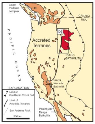 Week two has come and gone. I assisted Amanda with little things as she got ready for finishing up the data analysis. We finished up the reciprocity early in the week and made corrections to our first arrival picks as needed. After this stage we converted the files and compiled them for use with Professor Hole's programs. Amanda has been working to get a model of the subsurface layers below the salton trough. I have been spending my time reading articles to become familiar with the geology and historical work done in Idaho for the IDOR project. The IDOR project looks at the evolution of the continental margin where it meets up with accreted terranes. Basically, the North American continent used to end mid-idaho. This was the ocean-side property of a long time ago. Island arcs of volcanos that had formed in the Pacific were slowly brought toward this boundary by the subduction zone and eventually smeared off onto the larger continental mass. These accreted terranes slowly built the west coast as we know it today. Much activity has happened at the boundary between the continental craton and these added blocks, including intrusion my magmas over time. I will continue reading articles throughout the week to get a better understanding.
Week One
June 24th, 2012
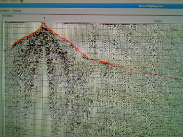
I have arrived in Virginia and gotten settled in. Amanda and I have been processing data from line three of the Salton Seismic Imaging Project. See her blog for more information about the project. We have been picking first arrival times and checking the reciprocity of these ray travel paths. When a shot sends out a wave front, that wave travels down into the earth, and as the velocity increases turns back upward until it reaches stations at the surface. In a perfect world, a shot at the location of that reciever would send a wave front right along the same path, and the ray would take the same amount of time to arrive. For my project, the IDOR project, planning has been difficult, but we're still heading out in July to do surveying for the eventual placement of the instruments. More next week.


