This activity is intended to extend students' learning of fundamental physics concepts (e.g. reflection, refraction and transmission of energy) through a real-world application.
Energy from an explosion travels through the Earth as seismic waves. Like other waves, seismic waves obey the laws of physics. For example, seismic waves have difficulty passing from one medium into another, hence they reflect (partially) from such a boundary. Waves also have different speeds in different media because each medium has its own rigidity. Different speeds in different rock layers give rise to refraction effects, including critical angle. Using basic physics principles and geometry, students examine seismic data to calculate the seismic wave velocities in several rock layers and then use this information to determine the depth to the boundaries, and estimate what rock type makes up each layer.
Students will be able to:
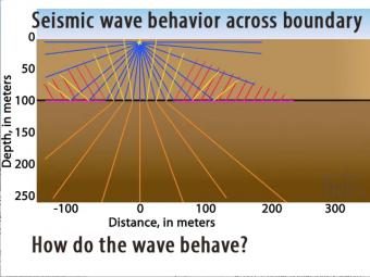
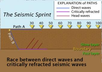
Seismic waves travel at different speeds through different materials. In this 2-layer model two wave fronts leave an impact at the same time but the lower layer is faster.
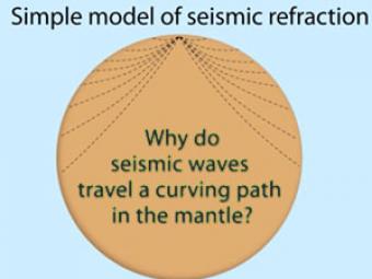
Seismic waves travel a curving path through the earth due to changes in composition, pressure, and temperature within the layers of the Earth.
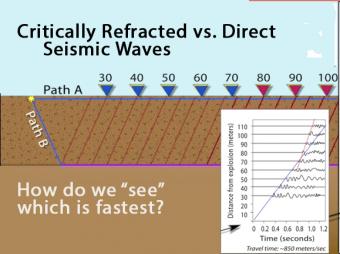
Animation shows the race between the direct seismic wave vs. the deeper, longer-path critically refracted seismic wave. Graph records the arrival times.
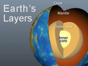
The Earth has 3 main layers based on chemical composition: crust, mantle, and core. Other layers are defined by physical characteristics due to pressure and temperature changes. This animation tells how the layers were discovered, what the layers are, and a bit about how the crust differs from the tectonic (lithospheric) plates, a distinction confused by many.
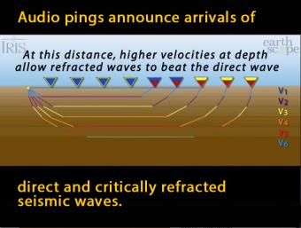
In this model of increasing velocity with depth, the critically refracted seismic rays speed up with depth as they pass 5 different velocity boundaries.
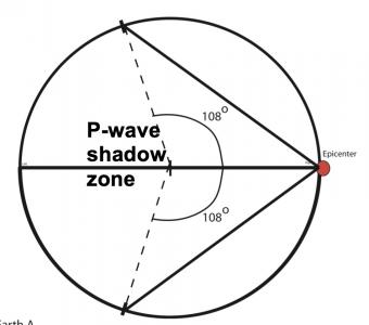
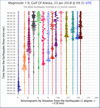
Students work first in small groups, and then as a whole class to compare predicted seismic wave travel times, generated by students from a scaled Earth model, to observed seismic data from a recent earthquakes. This activity uses models, real data and emphasizes the process of science.
We encourage the reuse and dissemination of the material on this site as long as attribution is retained. To this end the material on this site, unless otherwise noted, is offered under Creative Commons Attribution (CC BY 4.0) license