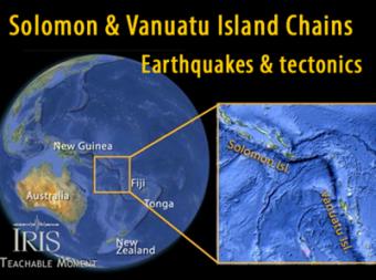
How is convergence accomodated in this complicated area?
The Solomon and Vanuatu Islands are subduction-related features caused by the subduction of the Indo-Australian Plate beneath the greater Pacific Plate. It is a seismically active area of frequent large earthquakes. This animation addresses both the subduction earthquakes, as well as a strike-slip component between the island chains. Basically the earthquakes are caused by the northeasterly movement of the Indo-Australian Plate as it dives beneath the Pacific Plate, but there are variations along the plate boundary
The Solomon and Vanuatu Islands occupy the center of a region that is marked by a complicated arrangement of tectonic micro plates crushed between the greater Pacific and Indo-Australian Plates. It is a seismically active area of frequent large earthquakes. The Australian continent is moving northeast at a rate of ~6 cm/year with variation along the boundaries up to 13 cm/year. In the region of the Solomon and Vanuatu islands, the earthquakes are caused by the northeasterly movement of the Indo-Australian Plate as it dives beneath the Pacific Plate.
CLOSED CAPTIONING: A .srt file is included with the downloiad. Use appropriate media player to utilize captioning.
Three areas in cross section to reveal a change from
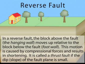
In a reverse fault, the block above the fault moves up relative to the block below the fault. This fault motion is caused by compressional forces and results in shortening. A reverse fault is called a thrust fault if the dip of the fault plane is small. Other names: thrust fault, reverse-slip fault or compressional fault]. Examples: Rocky Mountains, Himalayas.
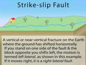
In a strike-slip fault, the movement of blocks along a fault is horizontal. The fault motion of a strike-slip fault is caused by shearing forces. Other names: transcurrent fault, lateral fault, tear fault or wrench fault. Examples: San Andreas Fault, California; Anatolian Fault, Turkey.
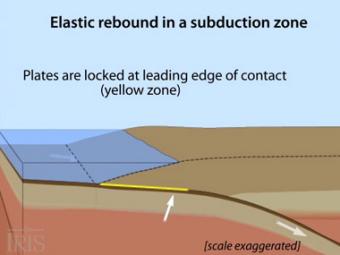
Oblique view of a highly generalized animation of a subduction zone where an oceanic plate is subducting beneath a continental plate. (See sketch below for parts.) This scenario can happen repeatedly on a 100-500 year cycle. The process which produces a mega-thrust earthquake would generate a tsunami, not depicted here.
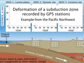
Subduction zones show that there are 3 distinct areas of movement in the overlying plate:
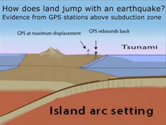
GPS records the movement of the leading edge of the overlying continental plate in a subduction zone. The plates are locked and the overlying plate is forced back. When friction is overcome and strain is released, the GPS receiver will snap back toward its original position.
We encourage the reuse and dissemination of the material on this site as long as attribution is retained. To this end the material on this site, unless otherwise noted, is offered under Creative Commons Attribution (CC BY 4.0) license