
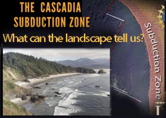
What does the landscape reveal about geologic processes?
The Cascadia Subduction Zone of the Pacific Northwest is comprised of a collection of major geographic features, including the subducting plate, the subduction plate boundary, the Coast Range, the Puget-Willamette lowlands, and the Cascades Mountain Range.
CLOSED CAPTIONING: A .srt file is included with the download. Use an appropriate media player to utilize captioning.
All these geographic features are related to the subduction zone:
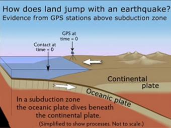
GPS can record the movement of the leading edge of the overlying continental plate in a subduction zone. The plates are locked and the overlying plate is forced back. When friction is overcome and strain is released, the GPS receiver will snap back toward its original position.
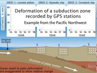
Subduction zones show that there are 3 distinct areas of movement in the overlying plate:
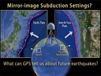
This animation compares Japan's subduction zone at the location of the 2011 earthquake with a mirror-image subduction zone in the Pacific Northwest. There are many similarities.
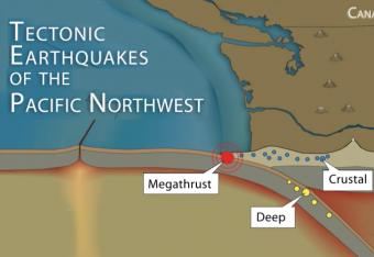
It is common knowledge that the Pacific Northwest can expect a subduction-zone megathrust earthquake in the future. But did you know that there are other types of damaging earthquakes. This animation uses analogies and cartoon block diagrams to teach about the three types of earthquakes.
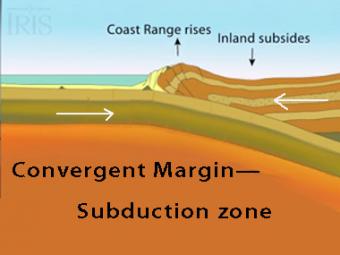
The subduction zone iswhere two tectonic (lithospheric) plates come together, one subducting (diving) beneath the other. The plates are locked together and periodically overcome the friction causing the leading edge of the overlying plate to surge back, lifting a wall of water producting a tsunami.
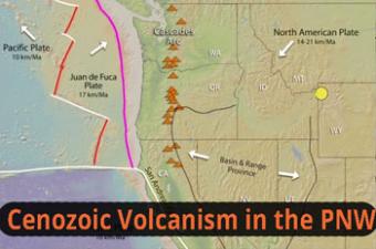
The Pacific Northwest boasts an active volcanic arc (Cascades), a nearby ocean ridge (between Pacific & Juan de Fuca Plates), the world’s youngest flood basalt province (Columbia River Basalt), a hot-spot chain of eastward-younging volcanoes (Yellowstone), Basin-Range extension, and more. This animation simplifies several complex tectonic interaction.
We encourage the reuse and dissemination of the material on this site as long as attribution is retained. To this end the material on this site, unless otherwise noted, is offered under Creative Commons Attribution (CC BY 4.0) license
