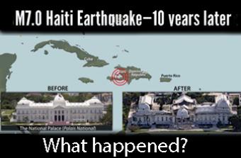
Why was this earthquake so devastating and deadly?
The human impact of the 2010 Haiti earthquake was horrendous, with estimates of at least 100,000 and likely up to 200,000 fatalities and over one million people left homeless. Haiti’s magnitude 7.0 earthquake struck a country where few buildings were built to engineering standards and were hopelessly fragile in the grip of such a strong quake.
This animation discusses the tectonic setting, the history of M 7 earthquakes in Haiti, as well as the aftermath of the earthquake.
For a slide presentation made in 2010 following the earthquake, see: https://www.iris.edu/hq/retm/event/918
CLOSED CAPTIONING: A .srt file is included with the download. Use an appropriate media player to utilize captioning.
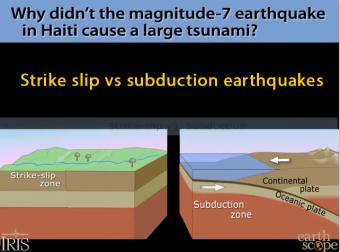
Strike-slips faults like the one that devastated Haiti don't generally cause tsunami, except for small local ripples. The Haiti earthquake was a horizontal motion. Tsunamis are caused by either an uplifting of the ocean floor, or by a huge chunk of land sliding into the ocean. Subduction-zone earthquakes raise the ocean bottom suddenly to push the water in tsunamis.
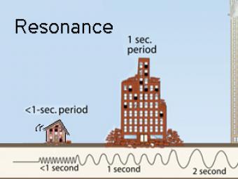
All buildings have a natural period, or resonance, which is the number of seconds it takes for the building to naturally vibrate back and forth. The ground also has a specific resonant frequency. Hard bedrock has higher frequencies softer sediments. If the period of ground motion matches the natural resonance of a building, it will undergo the largest oscillations possible and suffer the greatest damage.
Highly generalized animation reflects the arrivals of P, S, and surface waves to 3 closely spaced buildings. Exaggerated movement of the buildings reflects the relative motion recorded by the seismograms.
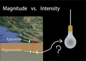
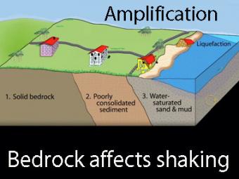
Earthquake intensity (what is felt during an earthquake at any given location) is often mistaken for earthquake magnitude (the instrumentally measured size of that earthquake). This animation describes the main factors that contribute to differing intensities using examples of earthquakes. Produced in collaboration with the U.S. Geological Survey.
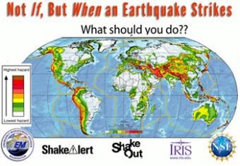
Drop! Cover! Hold On!
We do not know where we will be when an earthquake strikes, but we can know how to protect ourselves when it happens. This animation shows quick steps to take in a variety of scenarios. Educators Q & A pdf file is available as an optional download.
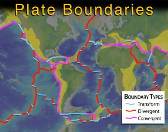
This intermediate-level animation describes what the tectonic (lithospheric) plates are and how they interact. It differentiates between continental and oceanic plates, and between the three major types of boundaries.
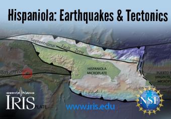
Hispaniola straddles four plates: the Caribbean Plate and the Gonâve, Hispaniola, and North Hispaniola microplates. It is squeezed between the North American and Caribbean Plates. The island, which includes both Haiti and the Dominican Republic, is home to 22 million people.
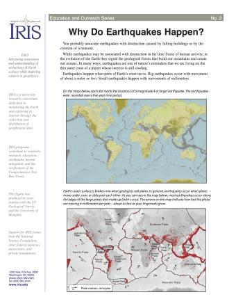
Many people associate earthquakes with destruction caused by falling buildings or by the creation of a tsunami. While earthquakes may be associated with destruction in the time frame of human activity, in the evolution of the Earth they signal the geological forces that build our mountains and create our oceans. This fact sheet provides an introduction to the causes of earthquakes.
We encourage the reuse and dissemination of the material on this site as long as attribution is retained. To this end the material on this site, unless otherwise noted, is offered under Creative Commons Attribution (CC BY 4.0) license