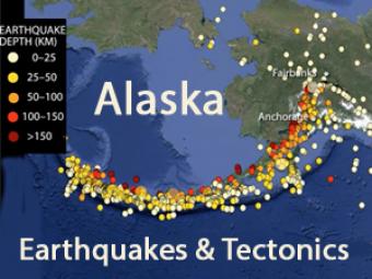
How do tectonics change across the 4,000-km-long trench?
Alaskan tectonics are dominated by the Pacific-North American plates. The megathrust boundary between the plates results in both the 4,000-km-long Aleutian Trench and in the arc of active volcanoes that lie subparallel to the trench. This animation discusses the range of tectonic activity from megathrust earthquakes to accretion of geologic terranes.
Alaskan tectonics are dominated by Pacific-North American plate interaction. The megathrust boundary between the plates results in both the 4,000-km-long Aleutian Trench and in the arc of active volcanoes that lie subparallel to the trench. This animation discusses the range of tectonic activity from megathrust earthquakes to accretion of geologic terranes. Along the trench, the rate of convergence ranges from 5 cm/year on the east to 7.8 cm/year on the west. The angle of subduction also changes from shallow in the east to steep in the west. In the Gulf of Alaska region, the subduction of the Yakutat plateau complicates the area, and is responsible for mountain building in the Chugach-St. Elias Ranges and the Alaska Range.
CLOSED CAPTIONING: A .srt file is included with the download. Use an appropriate media player to utilize captioning.
Alaskan tectonics includes:
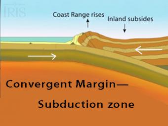
The subduction zone iswhere two tectonic (lithospheric) plates come together, one subducting (diving) beneath the other. The plates are locked together and periodically overcome the friction causing the leading edge of the overlying plate to surge back, lifting a wall of water producting a tsunami.
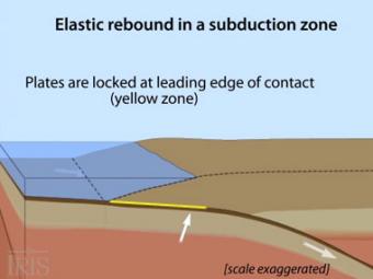
Oblique view of a highly generalized animation of a subduction zone where an oceanic plate is subducting beneath a continental plate. (See sketch below for parts.) This scenario can happen repeatedly on a 100-500 year cycle. The process which produces a mega-thrust earthquake would generate a tsunami, not depicted here.
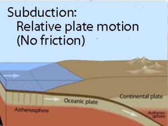
Oblique view of a highly generalized animation of a subduction zone where an oceanic plate is sliding beneath a continental plate with no friction just to show the relative motion between the plates..
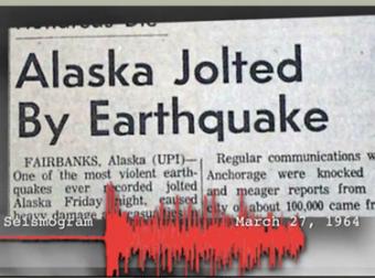
The 1964 Great Alaska Earthquake occurred on Good Friday, March 27th. Liquefaction in and around Anchorage tore the land apart. At magnitude 9.2, it was the second largest quake ever recorded by seismometers.
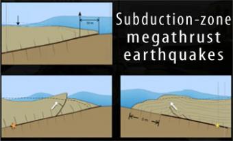
Subduction-zone megathrust earthquakes, the most powerful earthquakes in the world, can produce tsunamis through a variety of structures that are missed by simple models including: fault boundary rupture, deformation of overlying plate, splay faults and landslides. From a hazards viewpoint, it is critical to remember that tsunamis are multiple waves that often arrive on shore for many hours after the initial wave.
We encourage the reuse and dissemination of the material on this site as long as attribution is retained. To this end the material on this site, unless otherwise noted, is offered under Creative Commons Attribution (CC BY 4.0) license