Novice English
Learners should be able to:
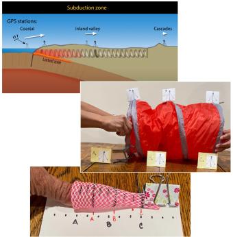
Tectonic plates are constantly moving, and GPS instruments help scientists measure this motion, identifying plate boundaries, deformation zones, and earthquake hazards, with rapidly changing regions being at higher seismic risk. This triad of activities engages learners in exploring authentic GPS data, using hand movements to model plate boundaries, creating vectors to analyze motion, and examining real-world GPS data to study deformation and earthquake risks in the western U.S. and Alaska. By interpreting data, role-playing geoscience careers, and learning about ShakeAlert, learners develop key skills in seismology, geodesy, and hazard preparedness while understanding the risks earthquakes pose to over 143 million people in the U.S.
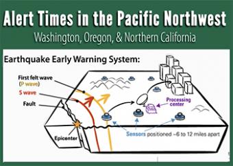
This set of hands-on activities helps students investigate ground deformation and earthquake hazards in the Pacific Northwest using physical models, real-world data, and map analysis. A brief demonstration with a compression spring illustrates how the subduction of the Juan de Fuca plate beneath the North American plate causes varying motion across the region. In longer activities, students measure compression, analyze GPS vector maps, and identify seismic hazard zones. By interpreting real-world data, students develop a deeper understanding of tectonic forces and connect these concepts to earthquake preparedness strategies.

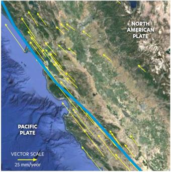
In this activity, learners explore ground deformation at and near plate boundaries using hand and body motions, data from GPS and maps. In the 5-minute activity, learners explore the concept of vectors by kinesthetically enacting ground movement using their body and hand movements. In the 20-minute activity, learners model GPS ground motion in different regions and connect deformation to earthquake hazards. In the 45-minute activity learners distinguish between different boundary types by measuring the vectors within tectonic plates and identify regions with higher earthquake hazards, comparing their findings to earthquake shaking potential maps.
What would you do with seconds to prepare for earthquake shaking? With even a few seconds, the ShakeAlert® Earthquake Early Warning can save lives and reduce injuries by alerting people that an earthquake may cause shaking near you as it triggers automated actions.
Más de 143 millones de personas en Estados Unidos están expuestas al temblor potencialmente destructivo de los terremotos.
¿Cómo funciona ShakeAlert? Esta animación explica cómo funciona ShakeAlert.
This new animation (2020) describes the ShakeAlert Earthquake Early Warning app: How it works, why we should have it. Made in collaboration with governmental agencies and universities on the West Coast.
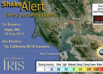
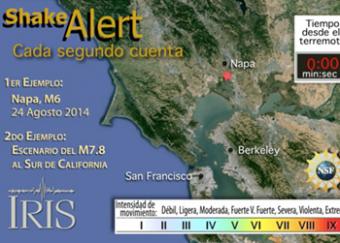
ShakeAlert (www.shakealert.org) is an experimental earthquake early warning system (EEW) being tested in the seismically vulnerable West Coast of the United States. This animation shows how ShakeAlert worked for the Napa earthquake, and how it could work for a large M7.8 hypothetical earthquake in Southern California.
ShakeAlert trabaja detectando ondas P que arriban a los sismómetros más cercanos al terremoto, enviando esas señales a la velocidad de la luz hasta un sistema computarizado que determina la localización de terremotos, y el tiempo de viaje de ambas ondas P y S a su localización, después alerta cuanto tiempo le queda hasta que lleguen las ondas S destructivas.
El 11 de marzo del 2011, un devastador terremoto de magnitud 9 sacudió la costa de Tohoku, Japón. El 26 de Enero del año 1700, la Costa Oeste de los Estados Unidos experimentó un mega terremoto generador de tsunami similar. Un terremoto como este estremecerá nuevamente la zona de subducción de Cascadia, impactando toda la Costa Oeste.
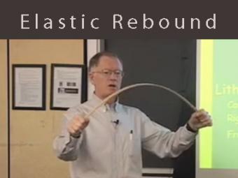
Video lecture about elastic rebound and brittle material in the crust using a yardstick as a mechanical analog. This demonstrates elasticity, brittle fracture, and why it is difficult to predict earthquakes.
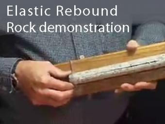
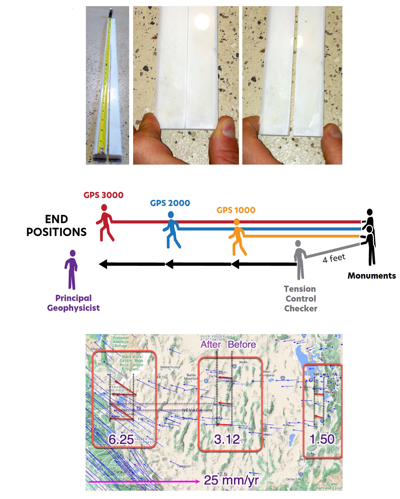
This demonstration shows that rocks are elastic by squeezing a slit core of rock.
We encourage the reuse and dissemination of the material on this site as long as attribution is retained. To this end the material on this site, unless otherwise noted, is offered under Creative Commons Attribution (CC BY 4.0) license