
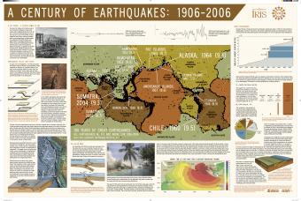
This poster outlines the lessons learned from the 1906 San Francisco earthquake and discusses 100 years of large earthquakes, including the Sumatra earthquake that caused a devastating tsunami.
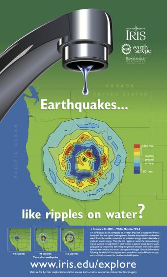
This poster combines a visualization of ground motion resulting from the February 21, 2008 M 6.0 earthquake that occurred near Wells, NV, with the image of a faucet to illustrate a classic Earth science functional analogy: "Seismic waves radiate outward from an earthquake's epicenter like ripples on water".
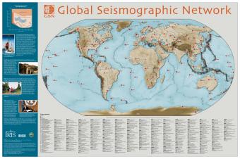
The Global Seismographic Network (GSN) consisting of more than 125 seismic stations provides data for scientific research, education, earthquake hazard mitigation, tsunami warning, and the international monitoring system for the Comprehensive Nuclear Test-Ban Treaty.
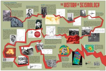
Depicting original sketches, photographs and colorful new imagery, this poster captures the major milestones of the development in the field of seismology.
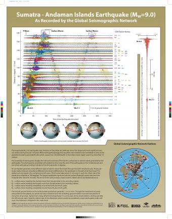
This assembly of seismograms displays the vertical movement of the Earth's surface due to seismic waves generated by the earthquake. The seismograms are plotted with respect to time since the start of the earthquake on the horizontal axis and are sorted vertically according to distance from the epicenter in degrees.

Seismic waves from earthquakes ricochet throughout Earth's interior and are recorded at geophysical observatories around the world. The paths of some of those seismic waves and the ground motion that they caused are used by seismologists to illuminate Earth's deep interior.
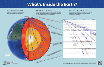
Seismic waves from earthquakes ricochet throughout Earth's interior and are recorded at geophysical observatories around the world. The paths of some of those seismic waves and the ground motion that they caused are used by seismologists to illuminate Earth's deep interior.
We encourage the reuse and dissemination of the material on this site as long as attribution is retained. To this end the material on this site, unless otherwise noted, is offered under Creative Commons Attribution (CC BY 4.0) license
 Loading ...